Varugad Fort in Man is a hidden gem that’s not for the faint of heart! Located about twelve miles north-west of Dahivadi, within the limits of Panvan village, the journey to Varugad is an adventure in itself. Your best bet is to camp at Pingli Budrukh, four miles south-west of Dahivadi, and travel thence by the Tasganv-Mograla road for about ten miles to Jadhavvadi, a hamlet of Bijvadi village lying almost a quarter of a mile east and within sight of the road.
From there, a well-marked track due west goes to the village of Tondle, and from Tondle, a path leads directly to the fort over rough ground. But don’t worry, the path is perfectly passable by a pony – just be prepared to cross innumerable small ravines and watercourses, and don’t forget your trusty hiking boots!
The surrounding landscape is terribly bare and rocky, so don’t be surprised if you come across a few small deer and chinkara. And if you’re lucky, you might even meet some well-to-do cultivators who are Gadkaris or descendants of the ancient hereditary fort garrison.
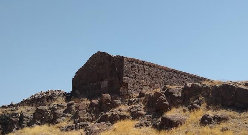
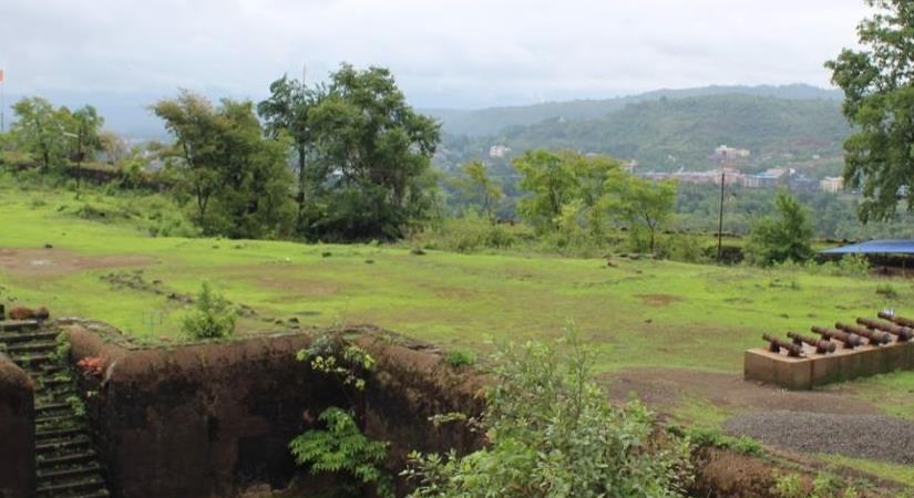
The fort itself is situated on a projection between two ravines and has been built on a hill of a truncated conical shape. The cone with the walls on it is seen from a great distance and appears very small indeed. But on near approach, it’s seen to be the inner citadel of a place of considerable size and strength for the times in which it was built.
As you explore the fort, you’ll come across some fascinating features. The outer wall or enceinte is entered by a rude gateway of a single pointed arch about eight feet high and five feet broad. And as usual, there’s a curtain of solid masonry inside. The gate lies about 150 yards east of the edge of the plateau, which there terminates in an almost unbroken vertical precipice of several hundred feet in height and receding in a north-easterly direction. No wall was built along about three hundred yards of this part, which is absolutely unscalable. But for the rest of the way, the walling is continued along the edge of the cliff and all around.
But watch your step! The path up the hillside to the upper and lower citadels is steep, and almost destroyed in places. About 150 feet up is the outer citadel built on a sort of shoulder of the hill and facing almost due west. It contains two massive bastions of excellent masonry looking north-west and south-west so that guns planted on them could command respectively the north and south gateways.
This citadel was connected with the main wall by a cross wall running across the whole breadth of the fort from east to west. Its entrance lies close below that to the upper citadel. A masonry curtain projects so as to hide the arch itself, which is not more than seven feet high by three broad, and has to be entered from due east. On the south side, the walls are carried right up to the scarp of the upper citadel and are some ten feet high, so that to take the lower citadel in rear or flank must have been difficult.
All in all, Varugad Fort is a must-see destination for anyone who loves adventure, history, and a good hike.
MUST visit places – NEARBY
Plan Your Trip to Varugad Fort
Check the latest prices and availability for the best stays in Varugad Fort.
Free cancellation on most rooms • No booking fees