Salher is a place located near Waghamba in Satana tehsil in Nashik district of Maharashtra, India.
It is the site of the highest fort in the Sahyadri mountains and the second highest peak at 1,567 metres (5,141 ft) after Kalsubai in Maharashtra and 32nd highest peak in Western Ghats.
The forts have a historic significance too. The Battle of Salher in 1672, between the Marathas and the Mughals, was the first ever open-field battle won by the Marathas against the Mughals.
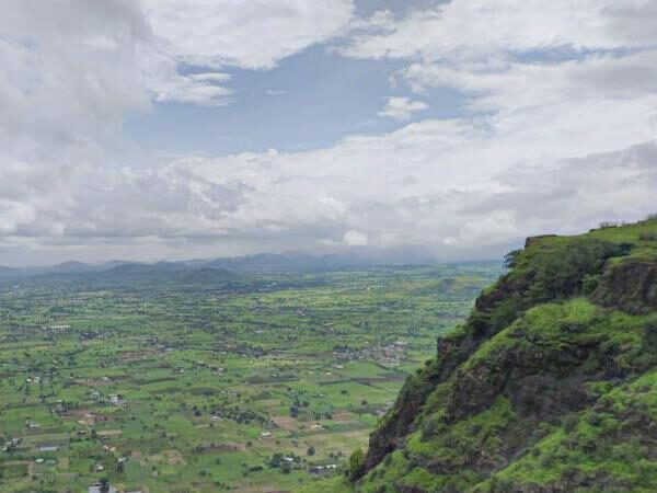
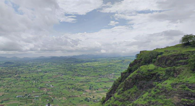
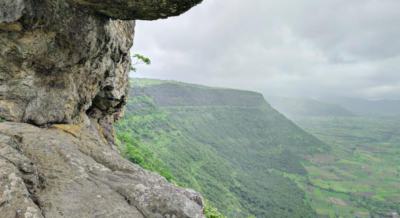
The trek is not just about the history, but also the breathtaking views that await you. Climbing on the top of one hill gives you a bird’s eye view of the other. From the top, you get a 360° view of the surrounding area, including the towns of Gujarat on a clear day. It’s like an actual drone shot!
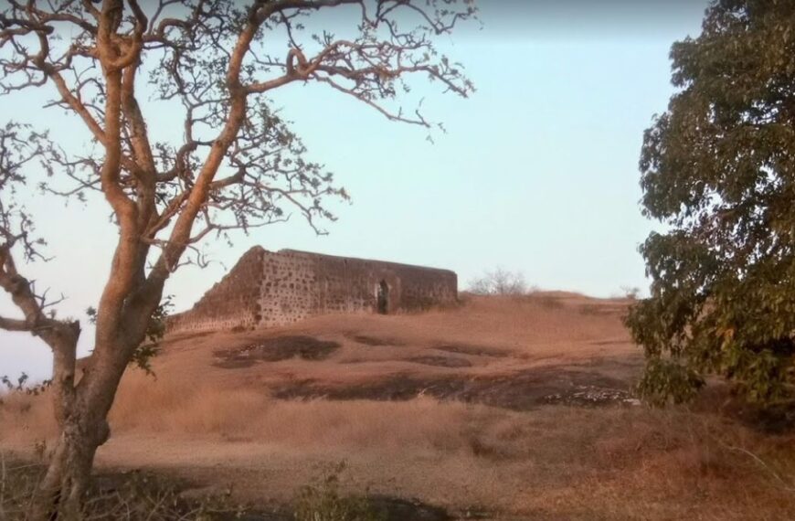
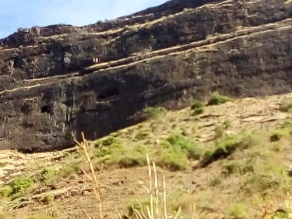
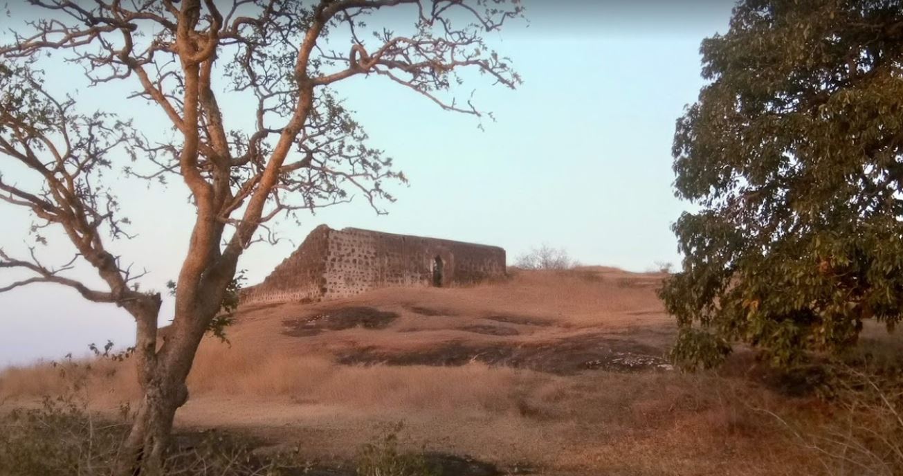
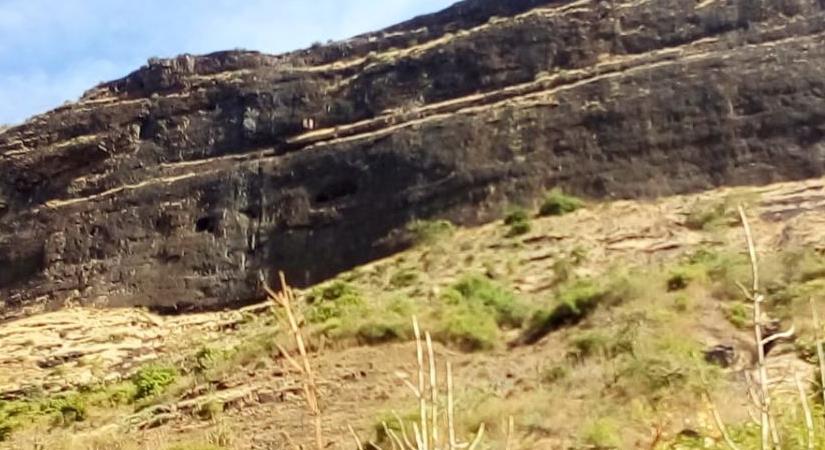
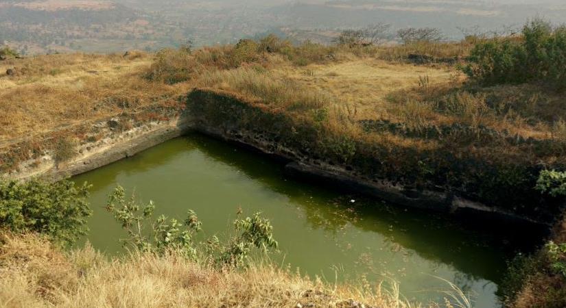
We can’t forget to mention the pond at the top of Salher fort and the temple at its highest point. And those caves built in a single line on the way to Salher fort? We can only imagine who used to stay in them. Maybe they were the original Airbnb hosts!
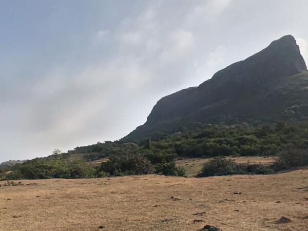
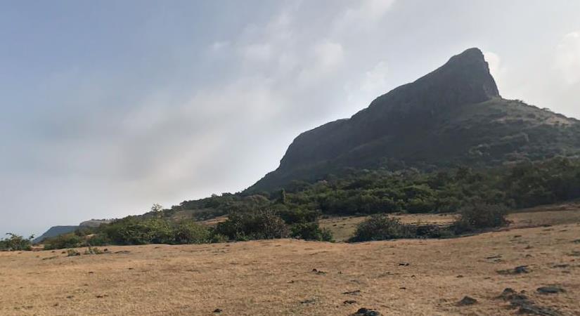
But, the trek is not for the faint-hearted. It’s a challenge that fit beginners and intermediate trekkers should take up. The trail is near vertical on both days and requires you to wade through rock-cut steps during ascent and descent. The naturally formed pyramid upon which the Salher fort is located is a marvel to see, and the rock-cut steps add to the beauty and provide a thrilling experience.
The trek starts from a village called Waghambe, but you can also start from another village called Salher Wadi.
And lastly, if you want to witness beautiful sunrise and sunset, Salher fort is the place to be. Whether you’re at Salher or Salota, you get amazing views of both. But, we recommend Salher fort for the height advantage.
So, pack your bags, grab your trekking shoes, and get ready for an adventure of a lifetime at Salher and Salota twin forts. Just don’t forget to thank us later for this awesome recommendation!
According to a legend, Lord Parshuram did his Tapascharya at Salher Fort. After winning the earth and giving it as donation, he made land for himself to live in, by pushing the sea back with his arrows, right from this place. The twin fort Salota (4986 feet) is very near to Salher.
An ancient and historically significant place like this is also famous for its battles during the reign of Chatrapati Shivaji Maharaj
Salher Fort was under Shrimant Sardar Suryajirao Kakade in 1671. The Mughals attacked the fort in 1672. Almost one lakh soldiers fought in this war. Many soldiers died in this battle but finally Shivaji Maharaj send Suryajirao Kakade who won the Battle of Salher. Of all the face to face battles between the Mughals and Suryajirao Kakade’s troops, the battle of Salher takes first place. Such a big battle was not won before. The bravery and strategy used by the Maratha troops in the battle spread far and wide and increased Shivaji Maharaj’s fame further. After winning Salher, the Marathas also captured Mulher and established their reign over the Baglan region. In the 18th century, the Peshwas occupied this fort and later by the British. The Marathas defeated the Mughals at the Battle of Salher in 1672.
Plan Your Trip to Salher Fort
Check the latest prices and availability for the best stays in Salher Fort.
Free cancellation on most rooms • No booking fees